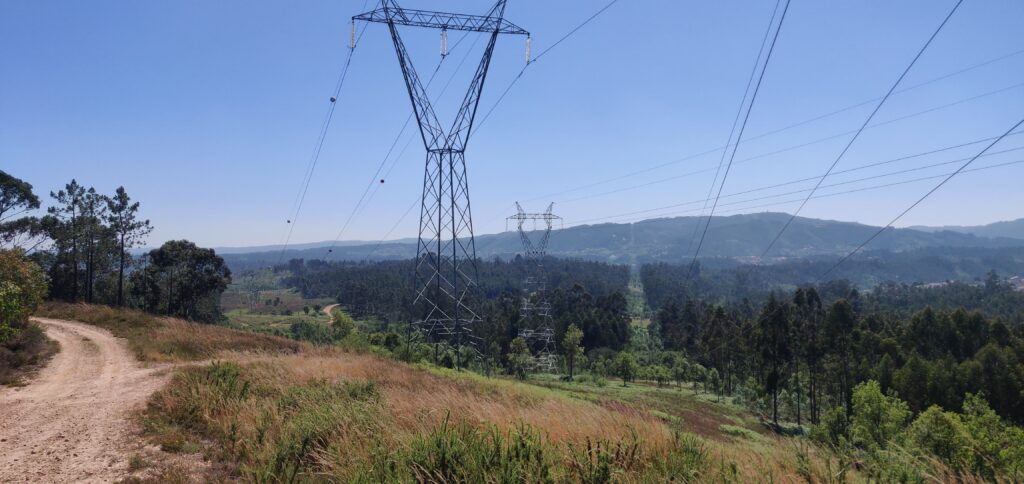
While the task of collecting 1000 kilometres of power line inspection data in a month seemed daunting at first, Hepta’s drone inspection teams were able to achieve it faster. A big part of this was thanks to them getting familiar with the grid on-site and surveying the area before the flights. This allowed them to start with a fast tempo from the get-go. While the mountainous terrain offered variable obstacles, from transit times in the area to flight planning and conducting, they were able to achieve and surpass their goals for data collection.
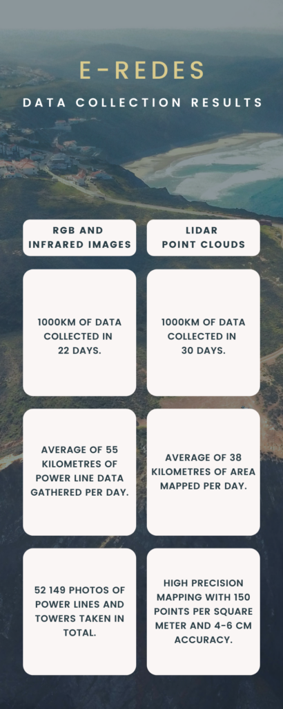
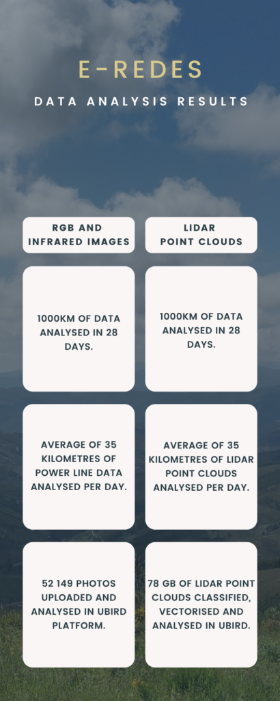
In the end, 1000km of overhead line RGB and infrared photos were collected on 6 lines in just 22 days. This resulted in an average of 55 kilometres of power line data gathered daily. During those 22 days, the Hepta drone teams took a grand total of 52149 RGB and infrared photos of power lines and towers.
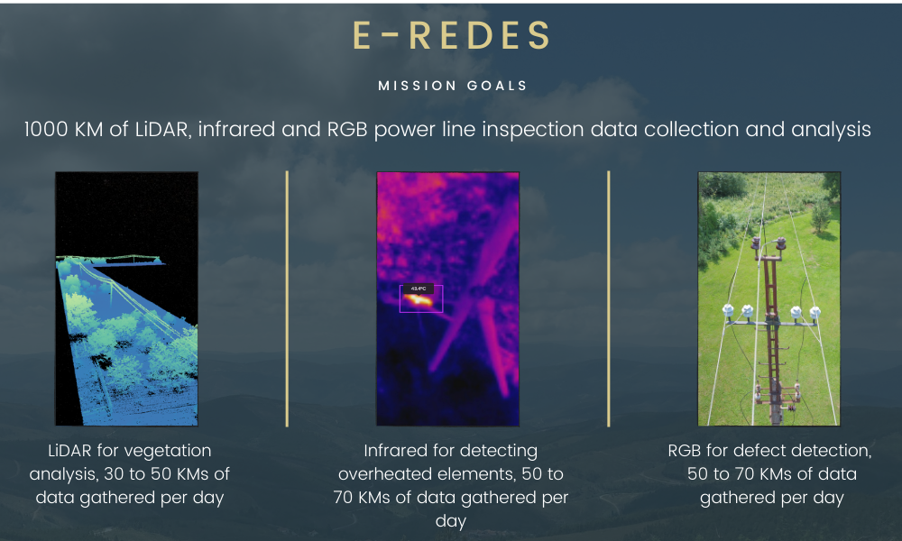
LiDAR mapping 1000 kilometres of power lines and the vegetation surrounding them was achieved in 30 days. On average, Hepta’s drone team was able to map 38 kilometres of power lines per day. All LiDAR mapping was done with high precision, with 150 points per square meter and 4-6 cm accuracy. The LiDAR point clouds were classified, vectorized, analyzed, and uploaded to Hepta’s power line inspection platform, Insights.