Estonian Railways and Hepta conduct pilot project to improve the safety and speed of utility inspection with drones and Hepta Insights software
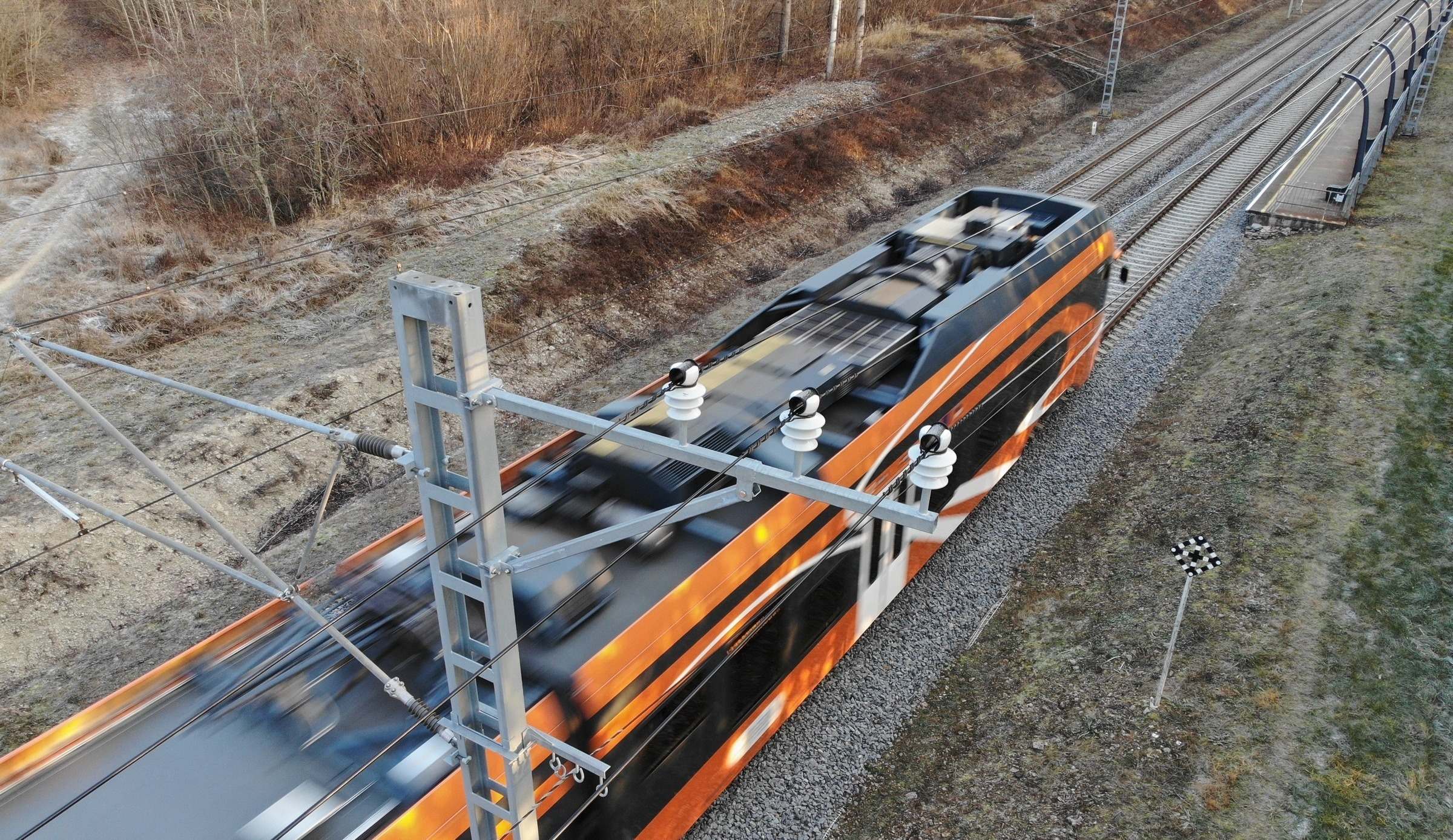
Hepta performed a partially automated railway utility inspection pilot project for Estonian Railways (EVR) in December 2020. EVR is a state-owned company that ensures the smooth operation, management, and maintenance of railway infrastructure, in addition to traffic management. EVR develops and maintains 1,214 km of railway infrastructure; including the rails, the powerlines that provide electricity to the trains, and the other utilities that need regular inspection and maintenance.
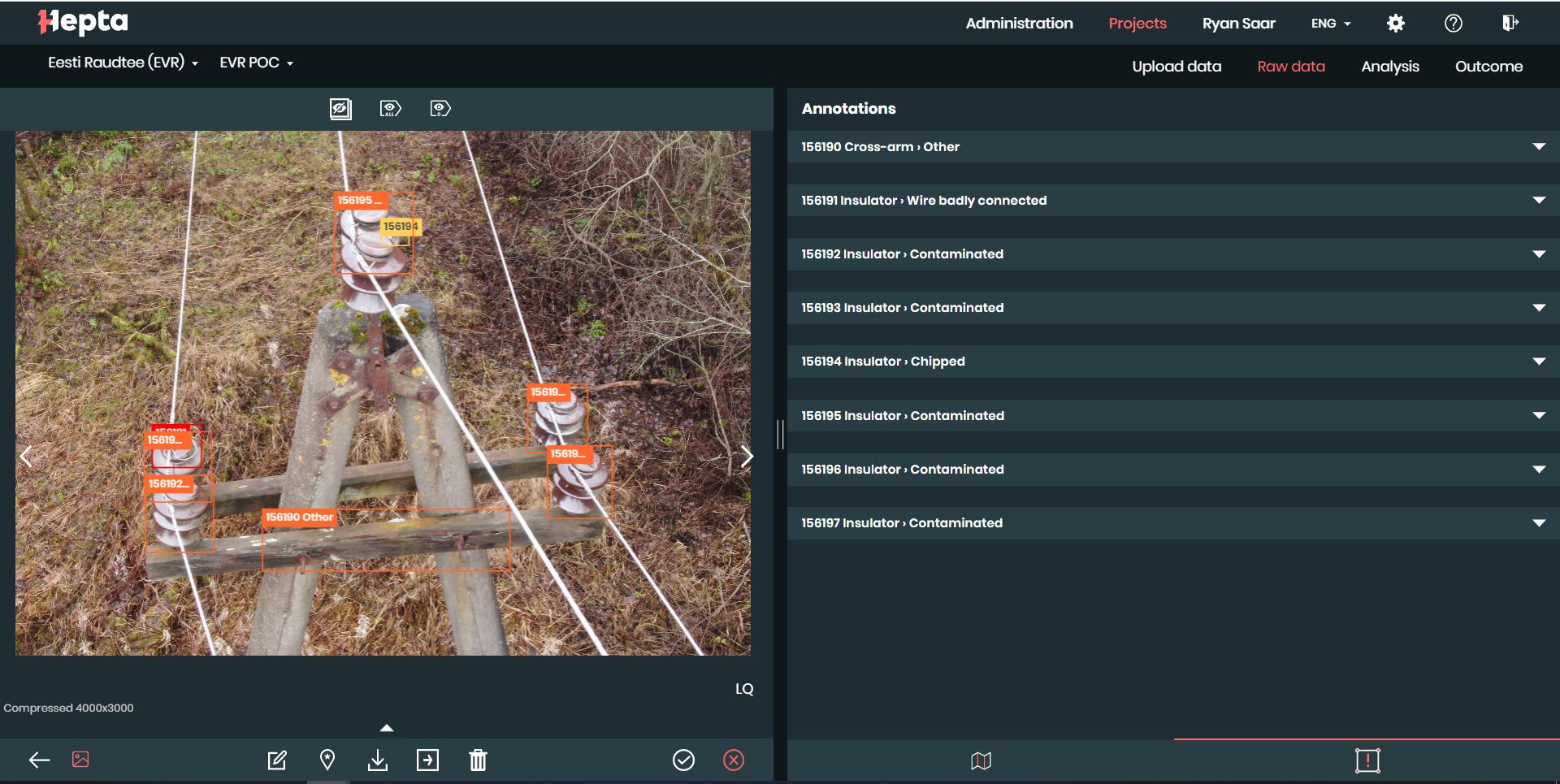
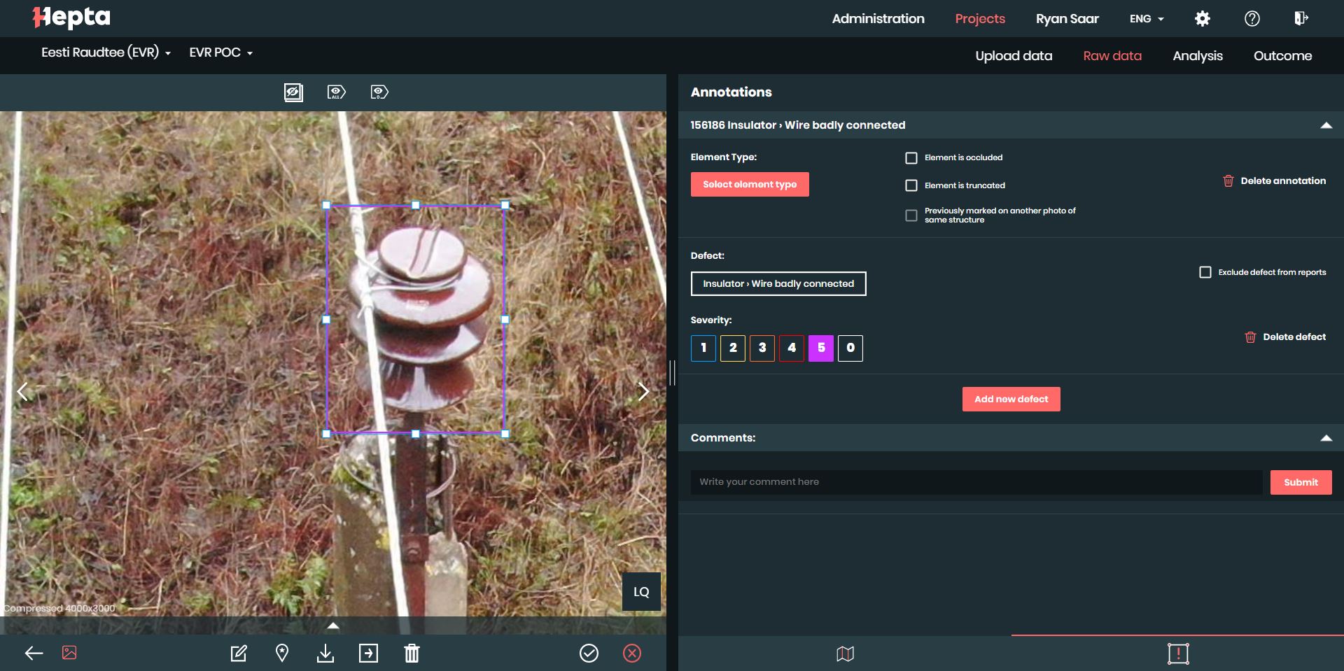
The goal for the pilot project was to apply innovative inspection methodologies to map railway infrastructure faster and without stopping railway traffic; while also increasing safety for railway employees. The project involved mapping as well as detecting any defects on the railway utilities using Hepta Insights software. Hepta software helps speed up the process of finding defects, mapping the positions of infrastructure objects, and creating actionable reports for maintenance teams. This was the first data collection and analysis completed of its kind with the railway grid in Estonia.
The main reasons to innovate railway infrastructure inspection
Traditional methods of railway utility inspection are hazardous work. Measuring and documenting such utilities are done manually, with employees physically walking along the railroad and under the lines. For example, marking the locations of poles and angles of crossings of pylons involves working on the railway, in a potentially immediate danger area, made all the riskier by electrical trains that make little noise and move fast. People who are deeply focused on their work generally pay less attention to their surroundings, which makes the chance of accidents all too high. When conducting inspections with drones, however, no people or aerial vehicles are put in harm’s way.
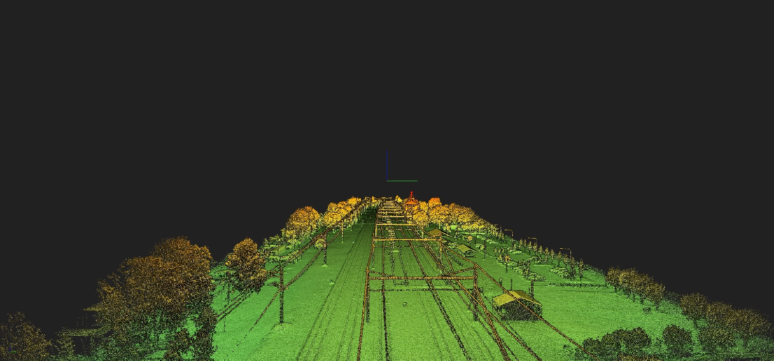
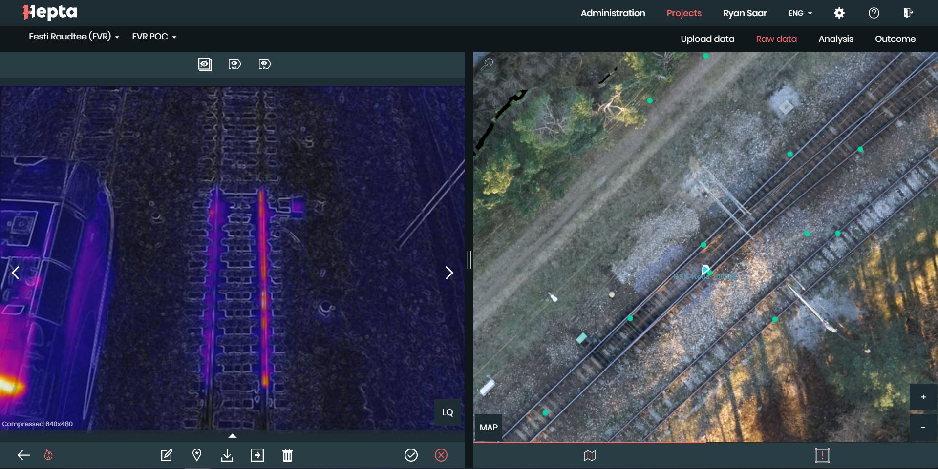
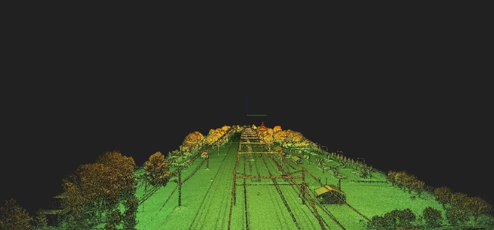
Mapping railway infrastructure also takes precision, and solutions that add speed to such manual work are in demand. Data gathered with drones, which is then analyzed by Hepta in the Insights software, provides additional input for EVR’s internal geoinformation system which maps their utilities. Input from the pilot project included the LiDAR point cloud, which was uploaded on a orthomosaic map and makes up the base layer for the data management system. In addition, a geo-referenced point cloud was created so the EVR team can take accurate virtual measurements of their infrastructure at any given time, without even going outside. For more in-depth defect detection, thermal imagery, as well as photographs of the railway elements, were also taken.
